
I started planning for this a year beforehand. I knew that everything west of the purple line on the map would be teeming with people: people from Portland, people from California coming up I-5, people from all over the Williamette Vally, the most heavily populated area of Oregon. So I had to find a location east of the purple line. I was coming from Jacksonville, marked with the dark blue star.
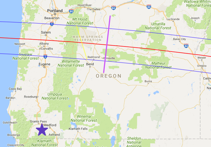
After poring over numerous Google maps, I selected a good location near Mitchell — a short distance east of the purple line.
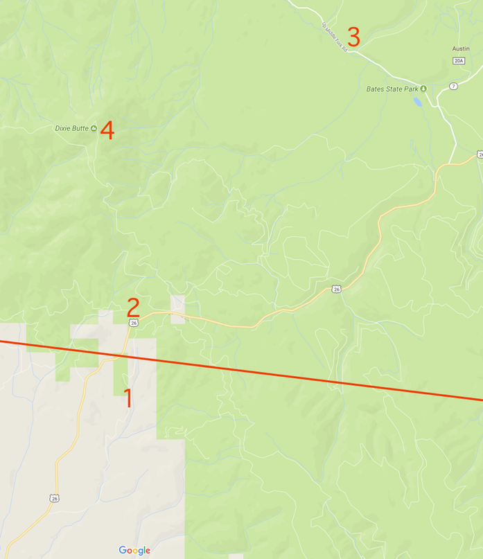
However, as the eclipse neared, we saw more and more warning stories about how crowded everything would be, so I started over. It is a seven hour drive from Jacksonville to the eclipse path in eastern Oregon, so I knew we’d have to spend the night, and there were no hotel rooms to be had. That meant that we’d sleep in the van, which in turn meant that we had to find a spot where we could park overnight without violating anybody’s property. That meant that we’d have to be in a National Forest; you can park a vehicle anywhere within 300 feet of a road in a National Forest. That led me to the northern blob of Malheur National Forest (shaded green area). Here’s a closer look at the area:
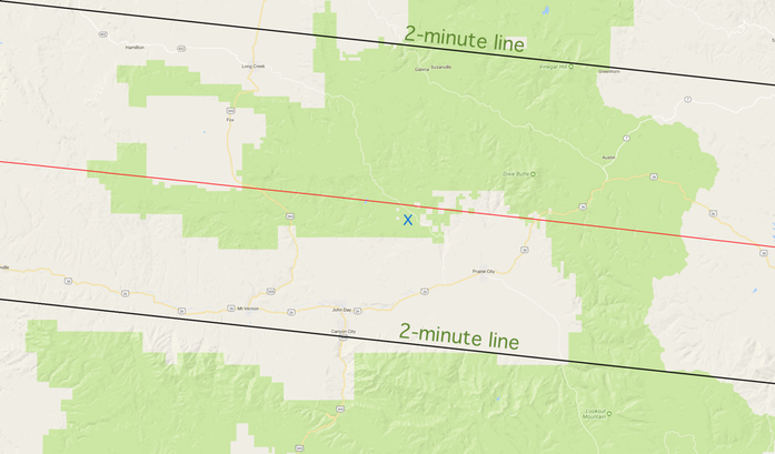
The eclipse would last about 2 minutes, 8 seconds along the red line; the further away from the red line, the short the eclipse. The black lines marked the limits at which the eclipse would last only 2 minutes. I had to find a location within those black lines. Let’s look even closer:
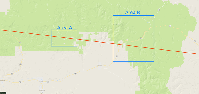
I zeroed in on two main areas. For emergency purposes, I also found a remote location in the National Forest just off the bottom edge of this map. I would use that if the traffic looked ghastly.
Here’s the aerial photo of Area A, along with the nine sites that, upon close examination, proved to have flat space within 300 feet of the road and not too many trees:
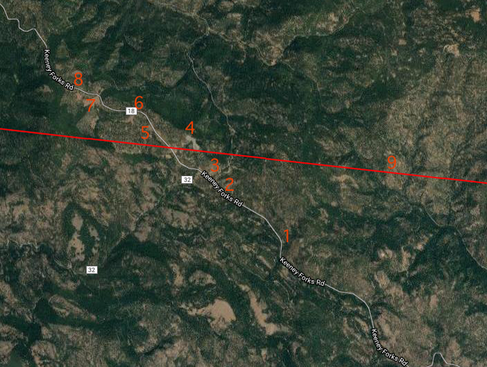
Site #4 looked best; here’s the closeup:
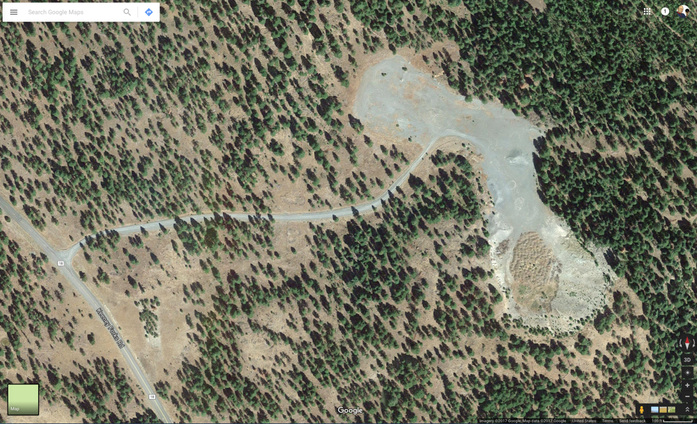
The large gray area is a gravel “pit” — except it’s on top of a hill. Here’s Google’s 3D view of the site, looking towards the direction of the eclipse:
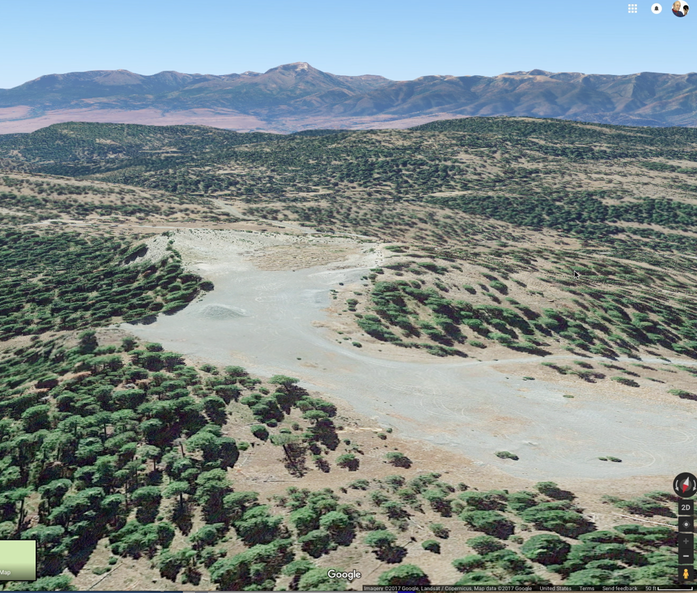
This is where we ended up. But I had identified plenty of other sites. Here is Area B:
I also stored maps on my laptop containing the locations of every gas station along the route, as well as every medical facility and a number of likely restaurants.
I also prepared my equipment carefully. I won’t describe it all; you’ll see it showing up in the photographs.
Joining Kathy and I would be my old friend Gemma, whom I have known since high school and who drove all the way up from San Francisco on Saturday, August 19th. On Sunday morning at 6:45 AM, we said goodbye to our dogs and took off. We drove for seven hours, fearing jammed traffic every mile. But the traffic was light all the way to our site.
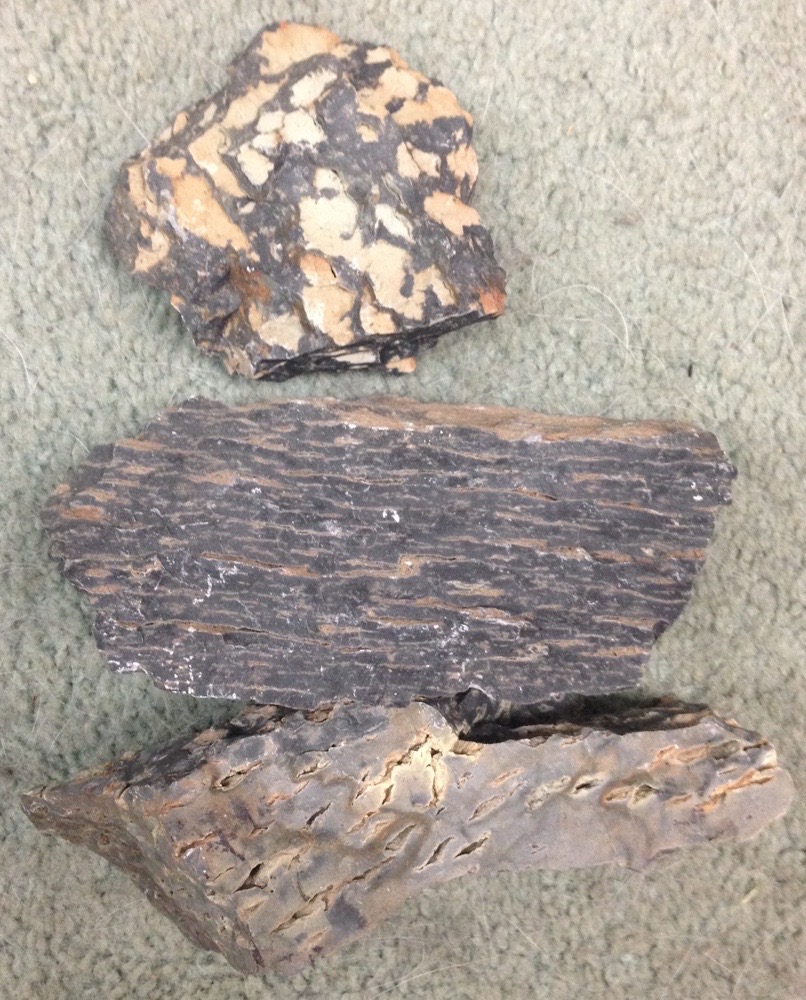
There were a lot of people at the site, but we found a good spot and set up camp. We rested and read for a while. Then I went for a walk looking for interesting rocks, and struck gold — sorta. I found some very interesting rocks.
These are all the same material. I was trying to figure them out when, as if by divine intervention, a geophysicist working as a consultant for mining companies happened by. He explained that this was “welded tuff”. You see, when a volcano erupts, it spews lots of ash — tiny particles of rock that fall to earth as a fine powder. That powder slowly compresses into a solid rock called “tuff”, which is soft and crumbly. If it’s old and has been buried deep, then it can be harder and firmer, but it’s still quite soft. But welded tuff is something else entirely. It starts with a “pyroclastic flow”, called “rolling clouds of murder” by geologist Mika McKennon:
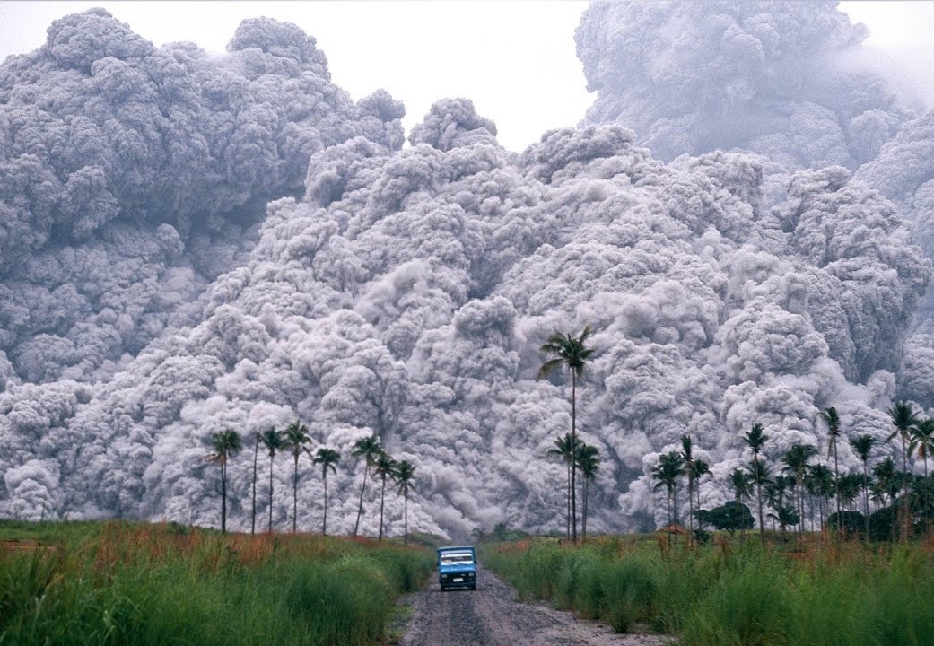
This stuff is a mixture of poisonous gases, ash, and steam. It emerges from the volcano at a temperature of several thousand degrees. As it spreads, the outer edges cool, but deep inside it remains horrendously hot. This kind of thing killed:
2,000 people at Pompeii in 79 CE.
30,000 people at St. Pierre in 1902
63 people at Mount Ontake in Japan in 2014.
When the gas-ash mixture hits the ground, it cools quickly and solidifies; a few seconds later, the cooler surface of the now-welded ash cools a layer above it. The process proceeds until the pyroclastic flow passes over the spot. You can see the layering in the middle rock below. The bottom rock shows places where bubbles of gas were trapped in the suddenly solidifying rock. Those bubbles are flat and wide; the top rock shows what they look like from above.
I pummeled the fellow with endless questions about all manner of geological subjects and in half an hour vastly increased my understanding of geology. The more you learn, the more questions you have. Our discussion was cut short by the deepening darkness.
Kathy, Gemma, and I ate some dinner and went to bed. Kathy didn’t sleep well in a sleeping bag in the van; I had few problems and slept well. Gemma slept in her tent outside.
Monday morning we got up early; here’s a photo of the site at sunrise:
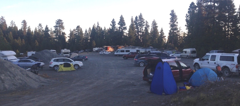
Here’s the site a few hours later:
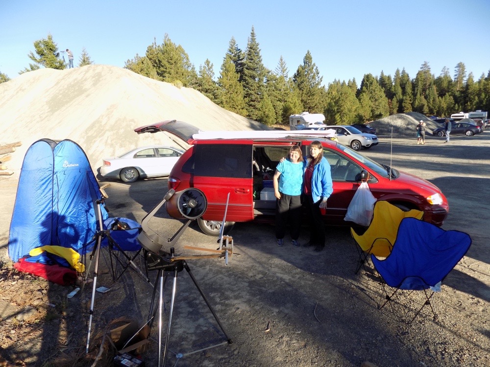
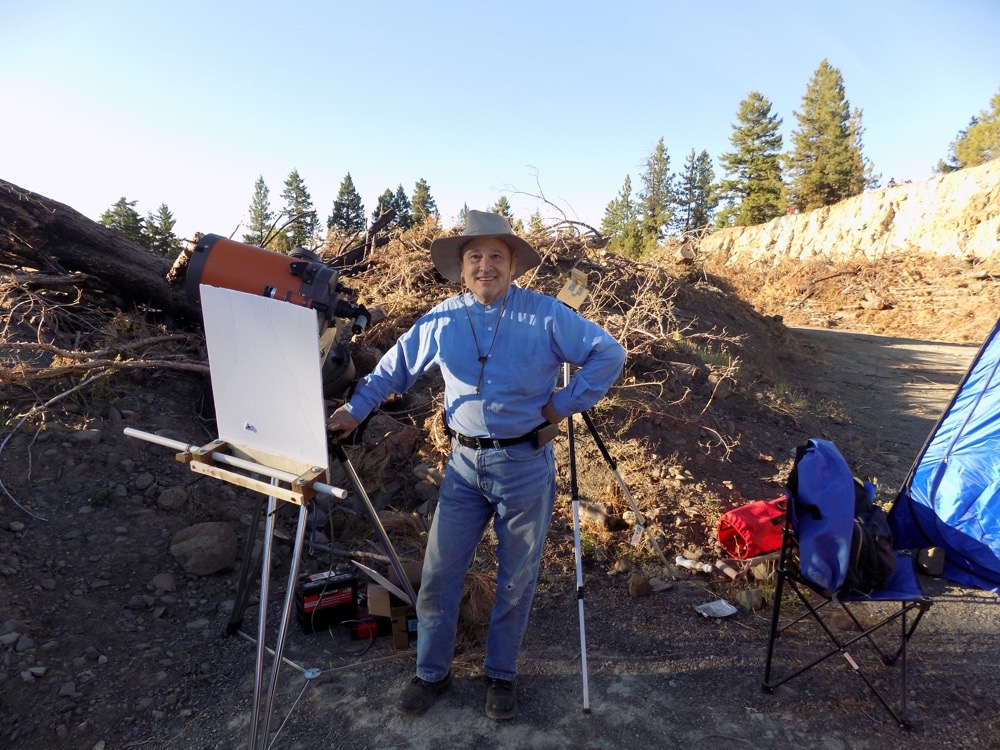
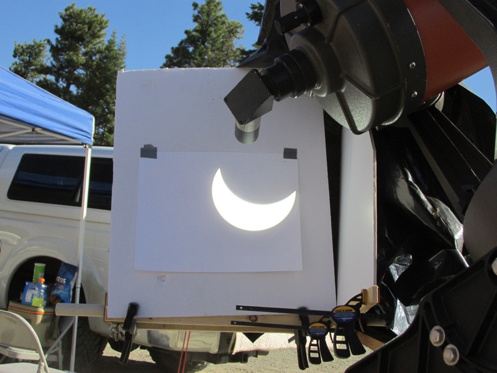
On the left is our “potty tent” that provides some privacy while using the camp toilet inside. Moving right, there’s a camera tripod and my telescope. Then the van, Kathy and Gemma, and our chairs. Here I am with my telescope and eclipse viewing contraption:
The viewing contraption (identifiable by the white board) allowed me to project the image of the sun in a way that allowed lots of people to watch the eclipse. Here’s what it looked like during the eclipse:
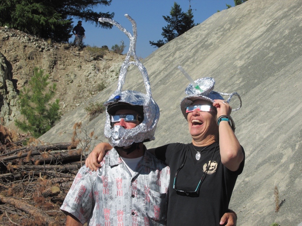
After all of my planning, I still failed to anticipate one development. People saw the eclipse on my contraption and wandered over to have a look. I explained what was happening and then answered their questions. Word traveled through the encampment about my contraption, and more and more people came by. Pretty soon we had a small crowd watching the show, taking photos of the sun’s image. Lots of interesting people came by:
I had them watch while the moon slowly covered the sunspots, pointing out that they were actually seeing the moon move. Many were surprised by the sunspots; they had never seen any. I ended up explaining stellar structure in order to explain the sunspots.
I had set up a white sheet stretched between two 2x4’s in anticipation of the eclipse bands. These are extremely faint bands of shadow traveling across the ground. They’re hard to see, but I managed to get a video just barely showing them. It’s 60 seconds long. Unfortunately, the camera kept trying to refocus, so only about half the video is in focus. You can see the bands travelling from upper left to lower right on the sheet. Also note the commentary from the audience. Totality begins right at the end of the video.
This unanticipated teaching opportunity turned out to be the most enjoyable part of the entire experience. I love teaching and the people there expressed their gratitude for showing them things they would never have otherwise seen.
One thing went very badly — and it was due to my stupidity. I set up my iPhone to record the slow darkening of the landscape as the eclipse deepened. I used the “time lapse” feature built into the iPhone. What I forgot was that the iPhone’s battery can only sustain the time lapse feature for maybe 45 minutes. So the iPhone ran out of juice a few minutes before the eclipse began. I had planned to use it to record the shadow bands as well as the color of the sky during the eclipse. There are good reasons to believe that the sky might shift its hue slightly during an eclipse. I had been taking photos of the blue sky under many different conditions all through 2017, so I had lots of data for comparison. But alas, I screwed up and failed to get the most important data.
I did use one camera to record video of the eclipse itself, but I knew it wouldn’t be any good, and my expectations were richly fulfilled. The dynamic range of brightness during an eclipse is far too much for any camera to handle. After searching the Internet, I found this photo showing most closely what it looked like to me, although the sun was much higher in the sky for me:
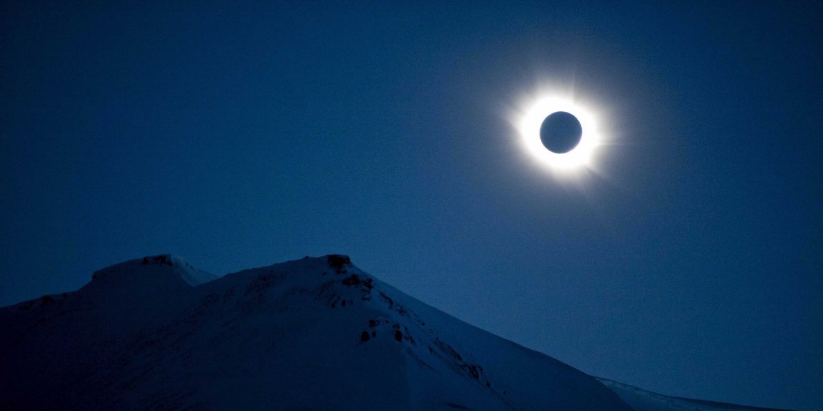
The image of the dark moon surrounded by the halo of the solar atmosphere is permanently burned into my memory. It was such a striking image, with the moon totally black, the halo slightly yellow, and the sky a deep, deep blue.
The loss of the iPhone screwed up things and I had so scramble during the 128 seconds of totality — quite consternating. I did manage to find my binoculars to look at the sun. I saw Mercury to its east. Several people saw Mars west of the sun. I asked around and it appears that the limiting magnitude — the faintest star that could be seen — was about 0, which suggests that the overall sky brightness was about what it would be about half an hour after sunset at temperature latitudes.
We didn’t want to get caught in traffic, so we had packed up most of our stuff by the time the eclipse began. We hurriedly packed up everything else and jumped in the car — and the battery was dead. Apparently we have left the doors open for so long that the interior lights had drained the battery. Fortunately, there were plenty of people happy to help, and we got it started up in just over five minutes. Then we headed out. Ten minutes later we hit the traffic jam of people entering the town of John Day. Here’s the time lapse video showing our departure up til the traffic jam:
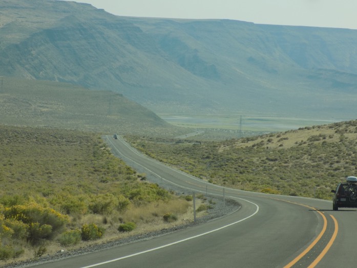
From the end of this video to the point where we escaped from John Day took another half hour. We ran into more jams all the way to the town of Burns over a hundred miles away. Most of the way we traveled through desert:
The trip home took seven hours. One last oddity:
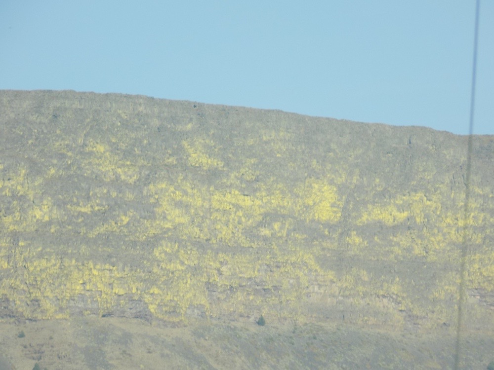
We did NOT see this yellow color the day before. I am certain that it is some kind of reflection, but I am at a loss to explain it. It is definitely NOT any kind of vegetation; it is intrinsic to the rock.
